
1. Data Collection
Acquiring GIS Data for site location
Performing data collection with survey grade RESEPI LiDAR and/or photogrammetry with full frame aerial camera.


2. Data Processing
Pre-Processing
Processing Color LiDAR Point Clouds
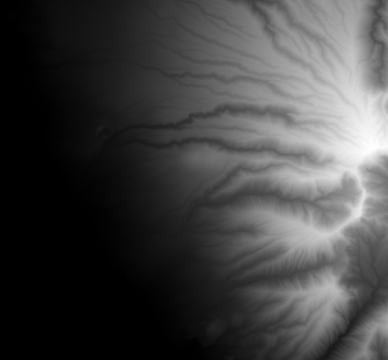
Haiku (Maui, Hawaii) Agroforestry plot
Initial Pre-Processed color point cloud of property and agroforestry site in Makena (Maui, Hawaii).
Initial Pre-Processed color point cloud in Kihei (Maui, Hawaii) after flooding.
Creating maps from processed point clouds


3. Data Visualization
Data derived Visualizations Simulations and Interactive experiences
Flow Simulations
Basic Flow Simulation on Digital Terrain Model (DTM)
Real-Time Fluid Simulation
Vegetation Growth
Successional vegetative growth, modeling.
Successional modeling
Ortho map placed in real-time visualization tool with added 3D plant species
Real-time Interactive experiences derived from real world data
Lahaina, Maui Hawaii, 1790s visualization from geospatial data
Playable interactive Lahaina, Maui Hawaii, Moku'ula, 1790.
Playable interactive, simulation and visualization of Lahaina, Maui Hawaii, Moku'ula, 1790.
Unlocking Insights from Geospatial Information
4. Data Interpretation
Our data interpretation services transform raw geospatial data into actionable intelligence. We offer a range of interpretation capabilities:
Basic Interpretation:
Understanding collected and processed data through maps, visualizations, and GIS-based solutions.
High-End Capabilities:
• Predictive modeling
• Digital twin simulations
Advanced Analysis:
• Spatial pattern recognition
• Geographic context evaluation
• Multi-layered data integration
• Temporal trend analysis
Statistical and visual analytical methods
Expert Consultation:
Tailored guidance to help you leverage geospatial insights for your specific needs.

Reach out to us
We are happy to hear your story and explore how our solutions can be part of your solution
Make informed predictions
Streamline stakeholder
communications
Visualize future outcomes